World Heritage Site Slate Landscape of North West Wales Map
The map highlights the 6 areas within the World Heritage site in North West Wales which are:
- Ogwen Valley
- Dinorwig quarryNantlle Valley
- Gorseddau and Bwlch y Ddwy Elor
- Ffestiniog and Porthmadog
- Abergynolwyn and Tywyn
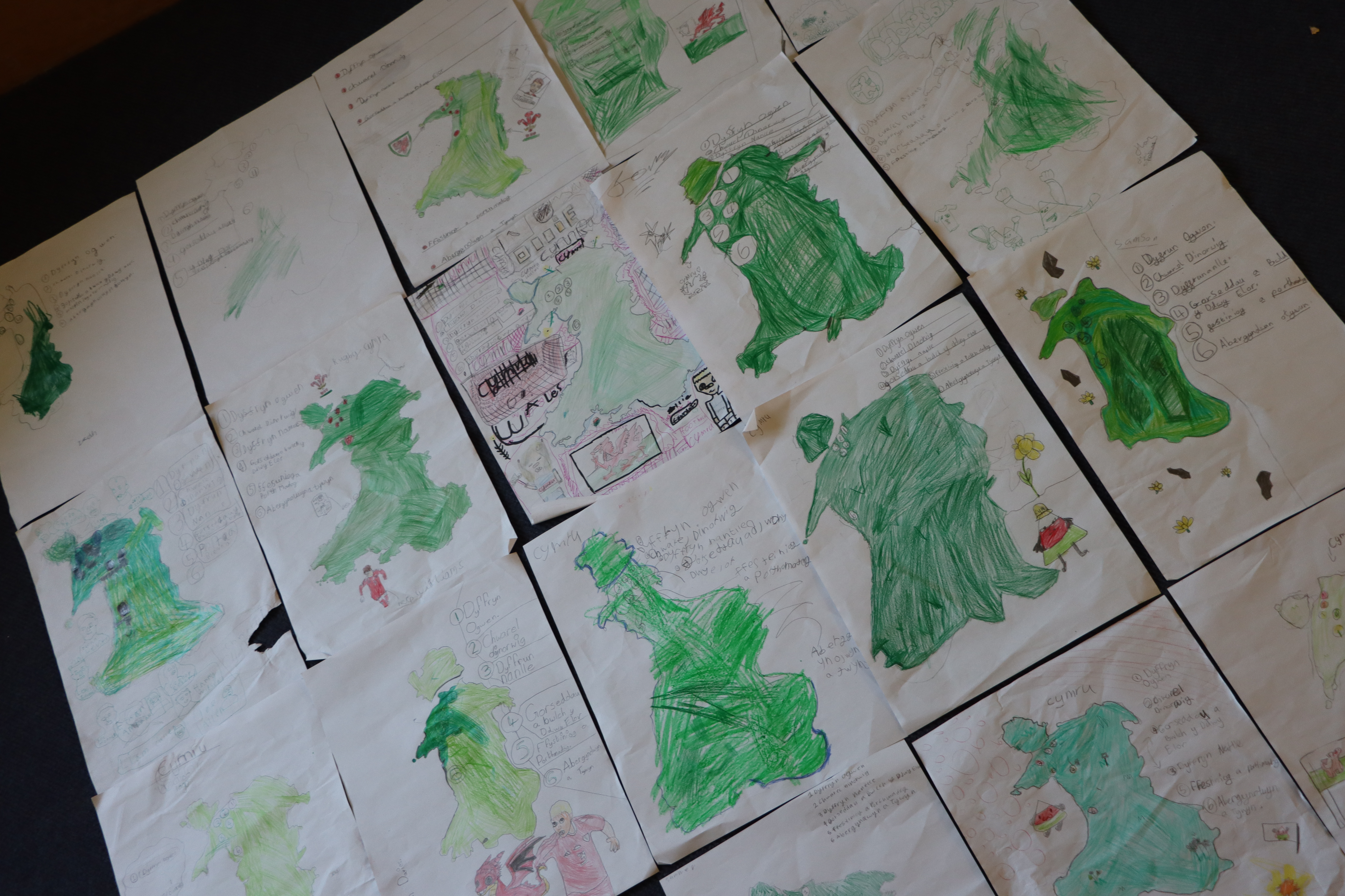
The images on the map are linked to the heritage and culture associated with the slate quarry areas. The resource can be used as a source of inspiration to encourage learners to create their own visual map as seen in the examples.

Example
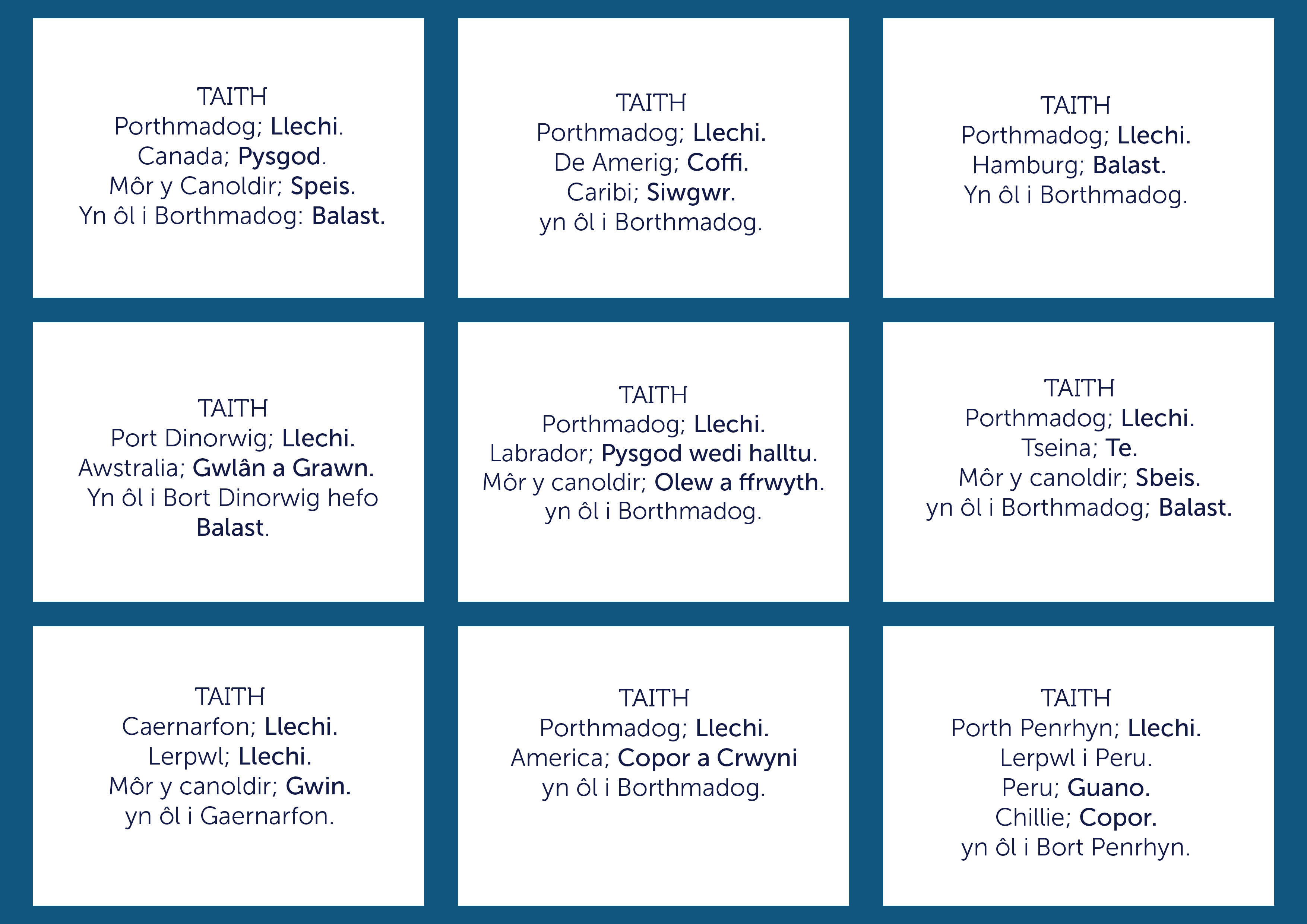
Sea voyages map
Sea voyages map, highlighting the ports used to export slate in North West Wales, as well as the types of ships used, and the tools used in shipbuilding.
The map can be used as an interactive resource in the classroom.
Step by step in the classroom:
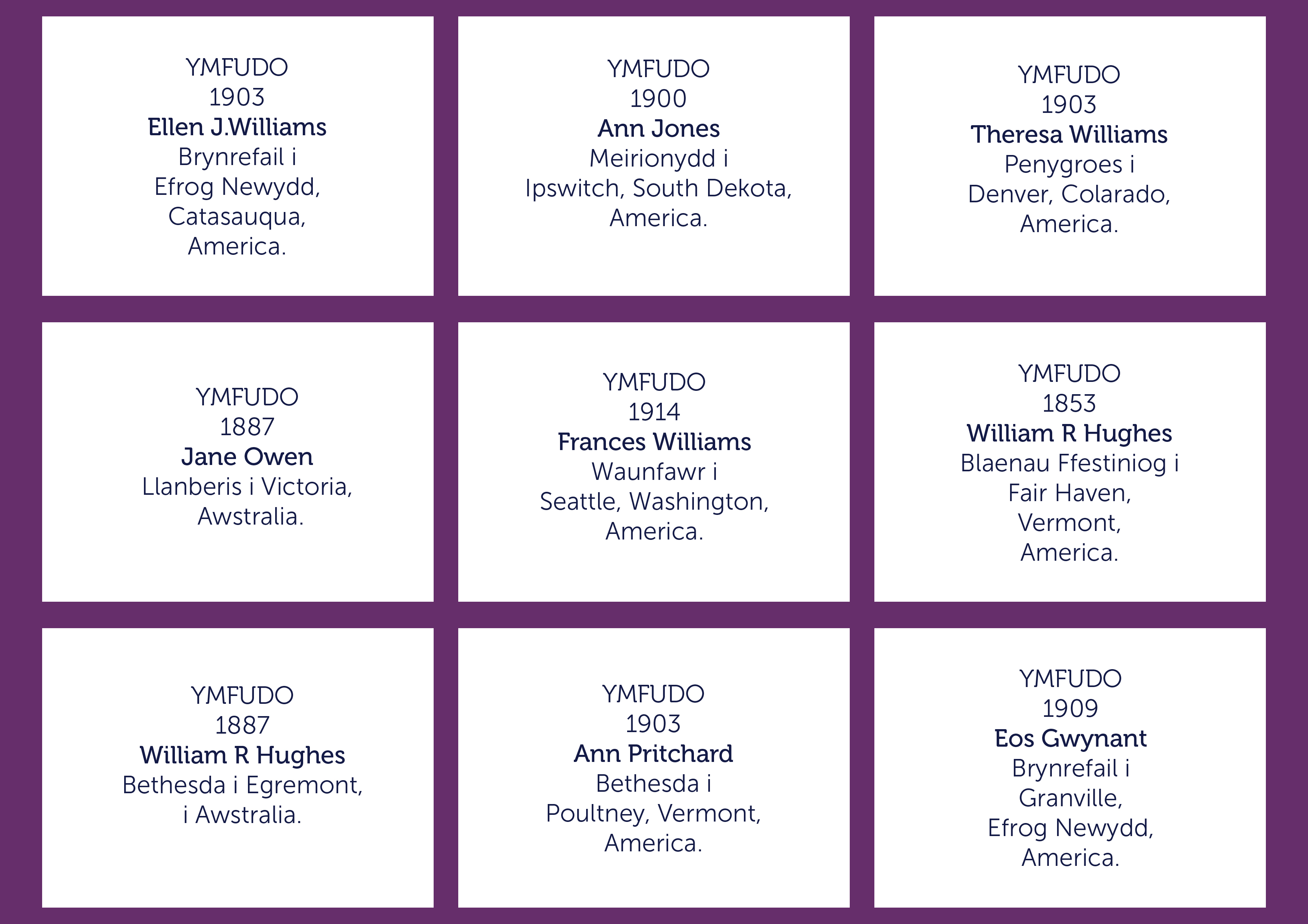
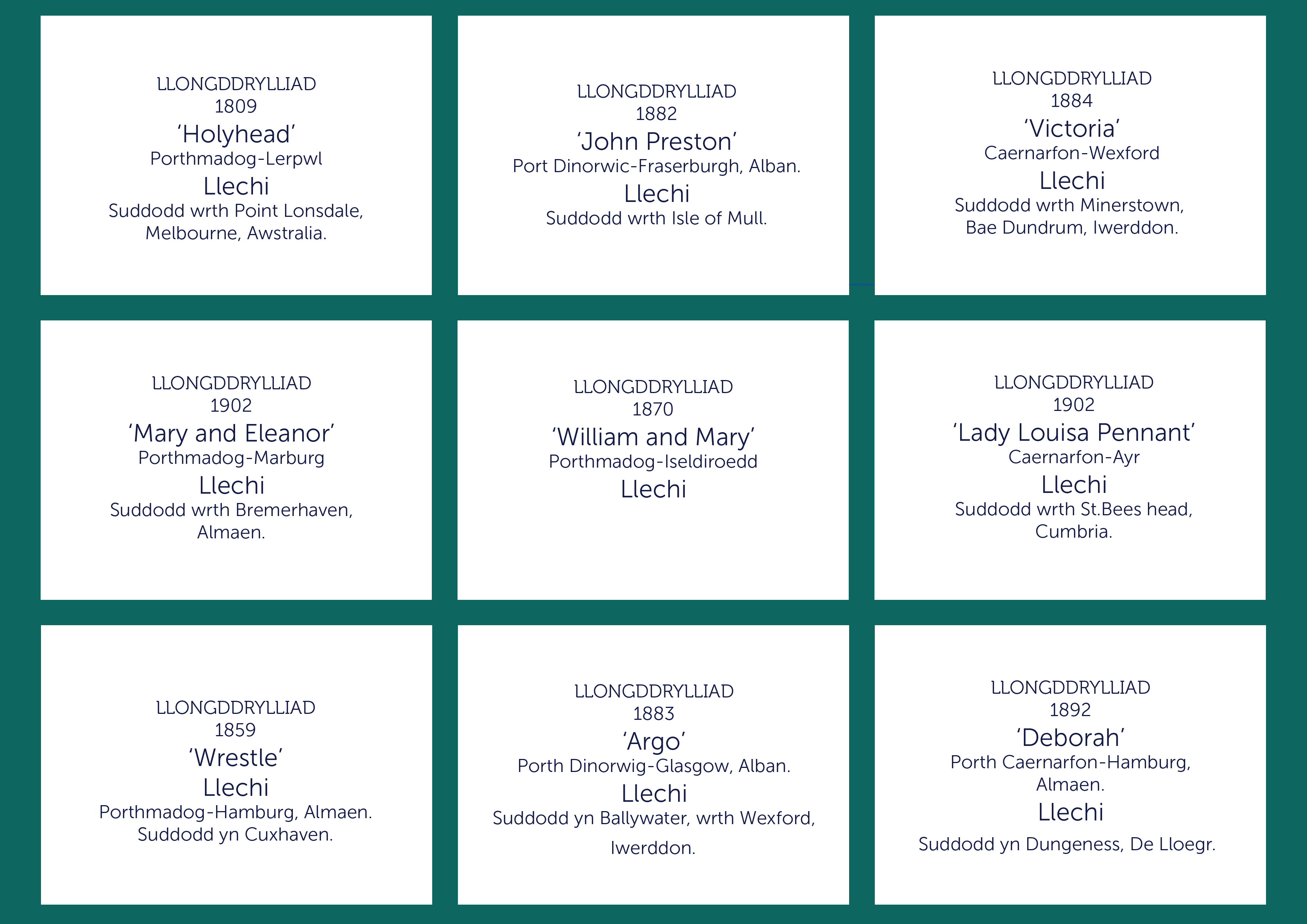
- Open the cards resource, themed categories; Shipwrecks, Emigration and Transportation of goods.
- Add the 'Voyages' map to the interactive white board.
- Ask the learners to research the journeys taken on their own devices, or maps.
- Learners share their journeys and encourage a group discussion, using the map on the white board.

Cards
Click on the images below to download the cards:
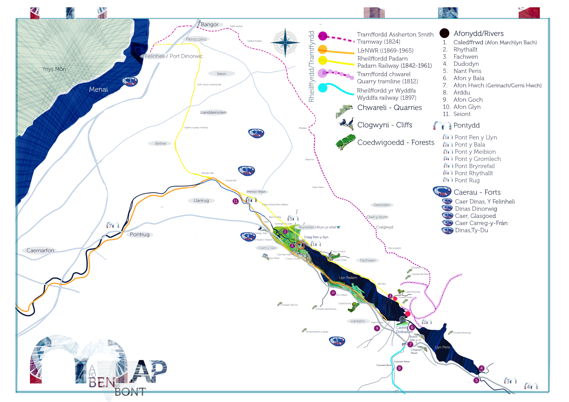
'A fo ben bid bont' - 'He who would be a leader let him be a bridge'
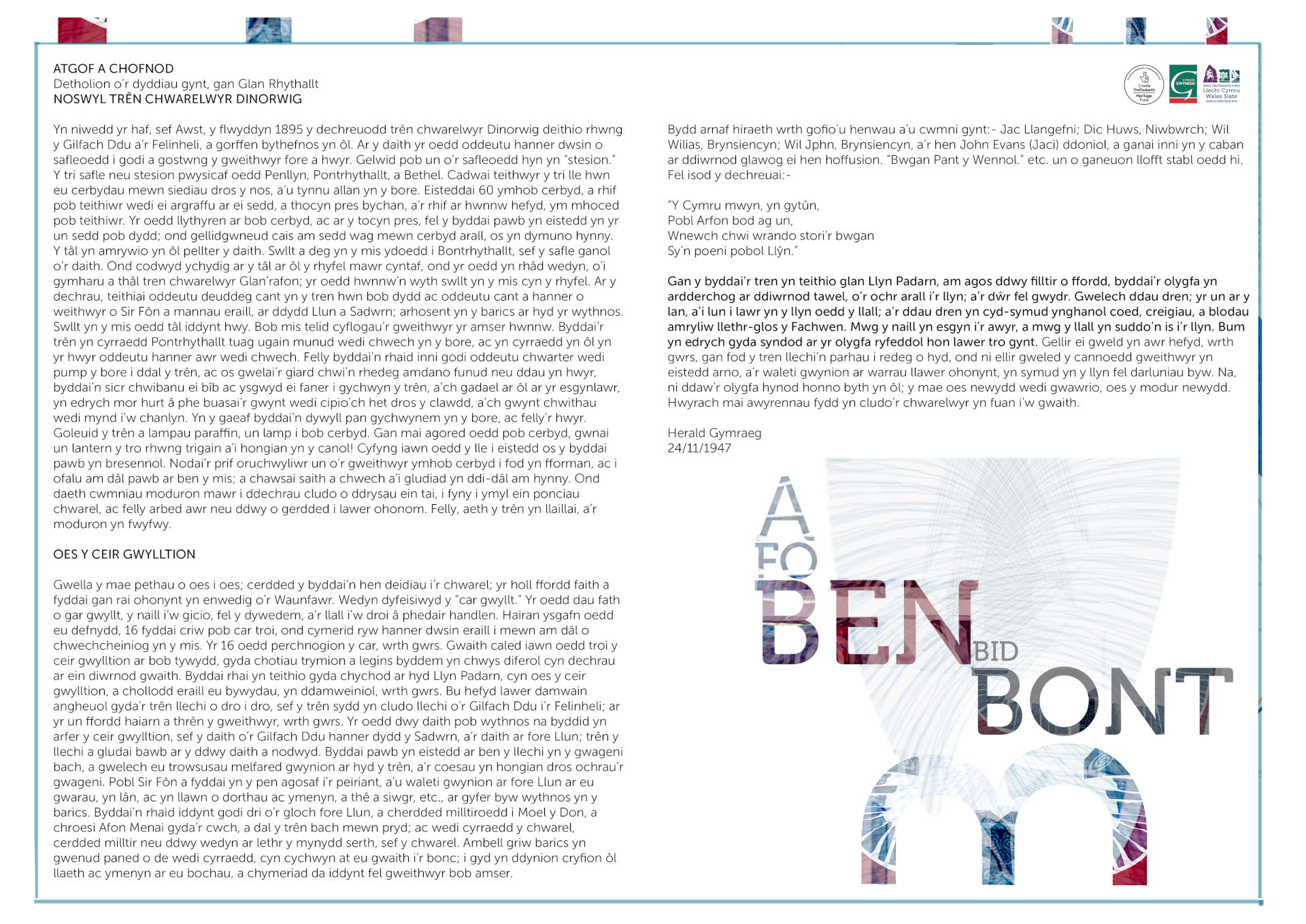
Map showing the train and tram lines used during the slate industry in the Llanberis area. Listed are the names of the rivers, bridges, hill forts, crags and forests in the area. Article transcription from ‘Yr Herald Gymraeg’ 1947,BY LLOYD, ISAAC SAMUEL ('Glan Rhyddallt '; 1875 - 1961),quarryman, writer and bard.describing the modes of transport in the Llanberis area 1800-1940’s.